How is the Mission Creek Subbasin managed?

The Mission Creek Subbasin has been managed for many years by the local water agencies. In 2003, the Mission Creek Groundwater Replenishment Agreement was enacted between the Coachella Valley Water District (CVWD) and Desert Water Agency (DWA). The subsequent 2004 Mission Creek Settlement Agreement led to the formation of the Management Committee, consisting of the CVWD, DWA, and Mission Springs Water District (MSWD). The Management Committee today continues to actively manage the Subbasin.
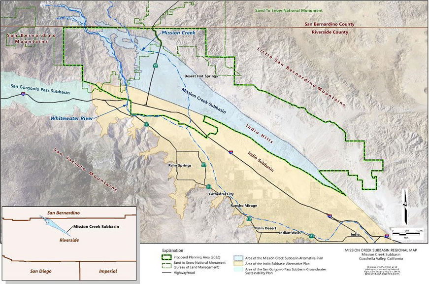
Mission Creek Subbasin Regional Map

DWA and CVWD both have contracts for imported water and operate a groundwater replenishment program to help fund groundwater recharge into the Mission Creek Subbasin. MSWD, and other large private pumpers pay a “Replenishment Assessment Charge” for each acre-foot of groundwater pumped.
What is the water cycle and how does it relate to groundwater supplies?

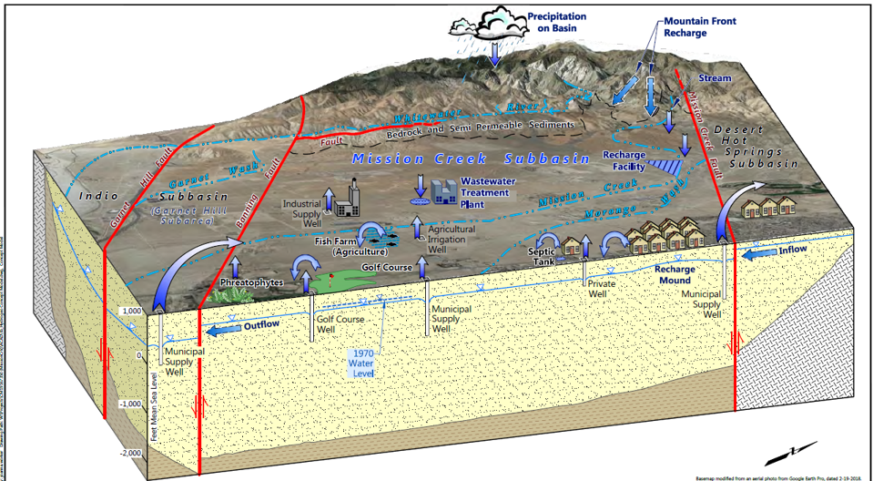
The earth has limited supplies of water. Groundwater and surface water are essentially one resource, physically connected by the water cycle in which water evaporates, forms clouds, and falls to the ground as rain or snow. Some of this precipitation seeps into the ground and becomes groundwater that moves slowly into an underground aquifer. If there is no precipitation, then there is no water returning to the groundwater below and the groundwater supply is not “recharged” or refilled.

The Water Cycle in the MCSB (Source: 2020 Annual Report)

What does “groundwater sustainability” mean?

The Sustainable Groundwater Management Act (SGMA) defines groundwater sustainability as “the management and use of groundwater in a manner that can be maintained during the planning and implementation horizon without causing undesirable results.” What does this mean? A sustainable groundwater basin is one in which the water use is balanced with the water replenishment from rainfall, surface water, and other sources.

How is groundwater replenished?

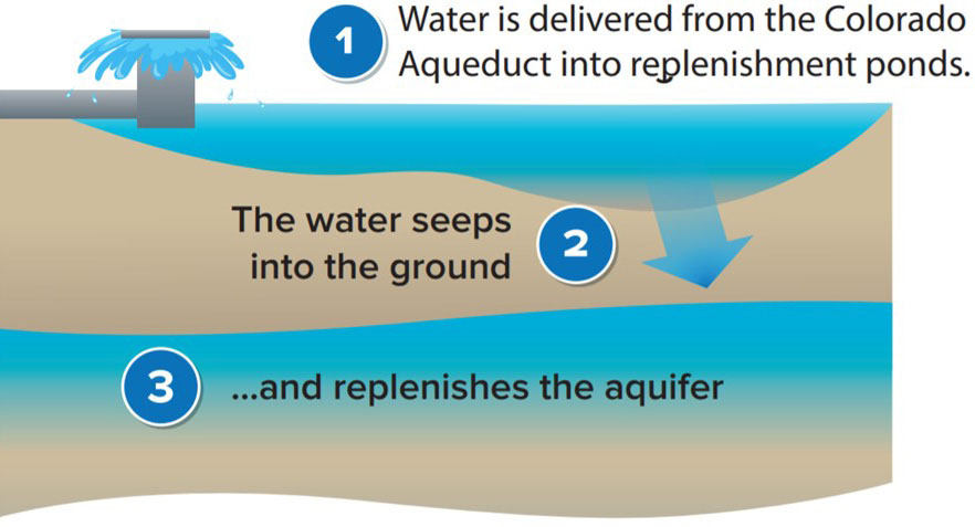
Groundwater basins can be replenished naturally and artificially when water from the surface is allowed to seep into the soil. The Mission Creek Subbasin is naturally replenished from the Mission Creek drainage with some subsurface flow also occurring from Desert Hot Springs Subbasin to the north. Water agencies in the Mission Creek Subbasin also artificially replenish the groundwater with imported water that is pumped into what are known as “recharge ponds” and allowed to seep into the ground.

How it Works
Groundwater Replenishment Example

What is the Mission Creek Subbasin?

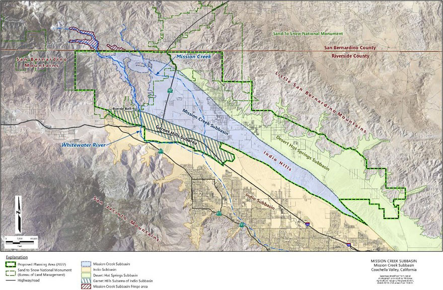
Within the Coachella Valley region, three faults associated with the San Andreas fault system bound the Mission Creek Subbasin. These faults separate the Mission Creek Subbasin from the adjacent Desert Hot Springs and Indio subbasins as well as the Garnet Hill Subbarea of the Indio Subbasin. The merger of the faults defines the southeastern boundary of the Mission Creek Subbasin. The Subbasin area is fully bounded on one side and partially bound on a second side by mountain ranges, which leads to groundwater replenishment from the mountain range runoff. Water within the Mission Creek Subbasin then slowly moves from the upper valley in the northwest towards the Indio Subbasin in the southeast.

What is an aquifer?

An aquifer can be thought of as an underground reservoir for groundwater. An aquifer is a body of porous rock or sediment saturated that stores groundwater in the spaces between sand, soils, and fractured rock. Groundwater stored in deep aquifers have accumulated over centuries or millennia.

What is the Mission Creek Subbasin?

The Mission Creek Subbasin is part of the Coachella Valley Groundwater Basin, and is designated as Basin No. 7-021.02 in the California Department of Water Resources (DWR) Bulletin 118 (DWR, 2016). See map below. The Subbasin is surrounded by the Little San Bernardino Mountains to the east, the San Jacinto and San Bernardino Mountains to the west, the Indio Hills to the southeast, and the Indio Subbasin to the south.

Mission Creek Subbasin
Mission Creek Subbasin Regional Map